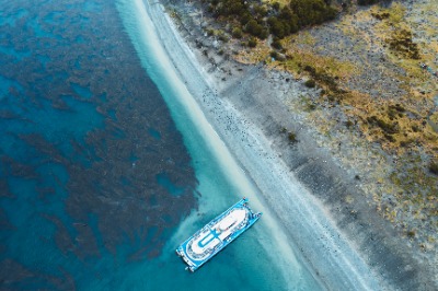
.jpg&w=3840&q=65&dpl=dpl_FHQZjh6P5HRpyqXx225jrjuYZTfN "Camping by the lagoon")
.jpg&w=3840&q=65&dpl=dpl_FHQZjh6P5HRpyqXx225jrjuYZTfN "highest peak of the route")

5-Day Dientes de Navarino Circuit Hike
Join a 5-day Dientes de Navarino adventure: guided trek with all meals, gear, and logistics covered
Tour available from November through March 📅
Briefing
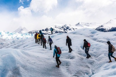
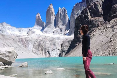
The 5-Day Dientes de Navarino Circuit Hike is the southernmost trekking route on the planet. With its 25 miles (40 km) of trail—or 31 miles (50 km) if you start and end in Puerto Williams—it’s one of the most remote and challenging hikes in South America. Join this 5-day, 4-night guided adventure that takes you deep into the heart of Navarino Island, in the far south of Chilean Patagonia, right across from the Beagle Channel.
Our tour includes everything you need for a worry-free experience: a pre-trip briefing, local guide and porters, transfers to and from the trailhead, satellite communication equipment, all meals during the trek, and mountain gear like sleeping bags, mats, and trekking poles. Plus, our team takes care of carrying tents, cooking equipment, and food, so you can focus entirely on enjoying the trail.
Group sizes are limited to 6–7 people, ensuring a personalized, safe experience filled with unforgettable moments.
🌄Are you ready to discover Patagonia at its wildest with us?
Tour details
Included
- Guide English / Spanish
- Technical talk
- Porters (carrying food and tents)
- Food
- Trekking equipment (trekking bags, mats, tents, poles, cooking utensils, crockery)
- Transfer at the beginning and end of the expedition
- Satellite equipment
Not included
- Entrance road to the island (Available as an extra)
- Hotel accommodation before and after the expedition
- Tips
Important information
Previous arrival (Day 0): You must arrive in Puerto Williams at least the day before the trek begins. On this day, we’ll hold the technical briefing.
Difficulty level: This is a medium-high difficulty expedition due to rugged terrain and unpredictable weather. It requires previous experience with multi-day trekking, camping, and carrying gear.
Minimum age: Participants must be at least 16 years old (with parental or guardian consent).
Scheduled departures: This tour has scheduled departures, approximately once per week. If you want to book for a different date, it will need to be in private service and will be subject to availability. Contact us for more information.
Cancellation policy
If you cancel at least 65 days before the start of the tour, you will receive an 80% refund of the total cost.
If you cancel between 64 and 35 days before the start of the tour, you will receive a 50% refund of the total cost.
After this time, or in case of no-show, no refund will be made.
*Reservation changes are subject to the same conditions.
Tour itinerary
5-Day Dientes de Navarino Circuit Hike
Welcome and pre-trek technical briefing
To kick off this adventure the right way, you’ll need to arrive in Puerto Williams the day before the trek begins. This day gives you time to settle in, acclimate, and meet our team before heading out on the southernmost route in the world. If you're arriving from Ushuaia, you can add the speedboat crossing to your reservation as an optional extra.
In the afternoon, we’ll meet for a technical briefing (around 5:00 p.m.) where we’ll review the itinerary, trail conditions, and safety guidelines. It’s also the perfect opportunity to meet the rest of the group, ask questions, and finalize any last-minute details.
We’ll provide the gear you’ll use during the expedition: sleeping bag, sleeping mat, and trekking poles, along with your trail rations. Tents, cooking gear, and main food supplies will be carried by our support team.
We’ll wrap up early so you can get a good night’s rest—Day 1 is just around the corner and the adventure is about to begin!

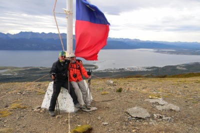
Day 1 Puerto Williams - Cerro Bandera - Laguna del Salto
Difficulty: High
Distance: 6.8 miles (11 km)
Estimated duration: 6–7 hours
Elevation gain: 1,970 feet (600 m)
✨Highlight: Cerro Bandera
Pick up and start of the trekking
The adventure begins in Puerto Williams, where you'll walk 2.2 miles (3.5 km) to the starting point of the Dientes de Navarino trail. You can choose to walk along a gravel road or take advantage of our transfer service, which picks you up at your accommodation and drops you off directly at the trailhead—so you can save your energy for the hike ahead.
The trail begins near a small cabin that serves as a Tourist Information Office and CONAF station, with public restrooms. This is your last connection to civilization before heading into the wilderness.
.jpg "Port Williams shuttle buses")
First challenge: the big climb
With your full pack—including food for 6 days (plus an extra ration just in case)—you’ll take on the steepest climb of the entire circuit: a 1,800-foot (550-meter) ascent over just 2.1 miles (3.4 km).
But don’t worry: the trail is well-marked and protected from the wind as it winds through native sub-Antarctic forest. Along the way, you’ll find viewpoints and benches for rest stops. At the top, you’ll reach Cerro Bandera, where sweeping views of the Beagle Channel reward your effort.

Second challenge: high Andean terrain and the slopes of the Róbalo Valley.
From Cerro Bandera onward, the trail crosses high Andean terrain along the eastern slopes of the Róbalo Valley—a section that can be challenging for those with vertigo due to its exposure. Wind is often strong here, so it’s important to stay close to the rock wall or crouch for safety when needed.
Once you spot Laguna del Salto in the distance, you’ll descend through rocky, unstable gravel until you reach the lake.
Laguna del Salto is an excellent place to spend your first night, with access to clean freshwater and several flat, dry spots for setting up camp. While space is limited, a bit of patience will help you find a comfortable place to rest.

Day 2 Laguna del Salto - Australian Pass - Laguna los Dientes
Difficulty: High
Distance: 5.6 miles (9 km)
Estimated duration: 5–6 hours
Elevation gain: 1,640 feet (500 m)
✨Highlights: Picacho and Dientes lagoon
Ascent to the high peaks
After breakfast, Day 2 begins by skirting Laguna del Salto on your right and crossing a small stream. You’ll then follow a second tributary that flows down a steep ravine—this becomes your trail. This section includes a steady climb and likely your first wet boots of the day as you head toward the high peaks of the Dientes de Navarino.
Paso Primero is a stunning mountain pass, often holding snow even in summer. Vegetation here is sparse, limited to resilient cushion plants that thrive in the alpine environment..

Australian Pass
The ascent continues until you reach Paso Australia, which marks the end of the Róbalo Valley. From here, you’ll see Laguna del Paso on the other side—a steep traverse along its right side awaits, and it's one of the most technically demanding parts of the circuit.
⚠️ Outside of summer, this area is often covered in ice and requires technical gear. Even in summer, if the rocks are wet or icy, it’s best to wait until the afternoon when conditions typically improve.

Arrival to the southern sector
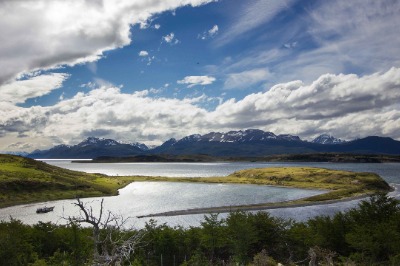
Crossing Paso de los Dientes brings you into the southern sector of Navarino Island. In clear weather, you'll be rewarded with sweeping views of Windhond Bay, Laguna del Paso, and—farther south—Nassau Bay and the Cape Horn archipelago.
The trail then flattens out, with gentler terrain and slight descents. On your right, you’ll pass Laguna del Picacho, and to your left stands the dramatic Picacho de los Dientes, rising to 3,668 feet (1,118 meters). Continuing south, you'll enter the Windhond Lake Heritage Trail valley, before turning east toward Laguna de los Dientes, a beautiful and recommended spot for your second night of camping.
The area around Laguna de los Dientes and Cerro Gabriel offers both open sites with panoramic views of the lagoon—ideal for sunrise—and sheltered forest campsites that provide protection from the wind and weather.

Day 3 Laguna de los Dientes - Laguna Martillo
Difficulty: High
Distance: 4.3 miles (7 km)
Estimated duration: 5–6 hours
Elevation gain: 985 feet (300 m)
✨ Highlight: Martillo Lagoon
Laguna de los Dientes
The trail continues alongside Laguna de los Dientes, which stays on your left as you hike past Cerro Gabriel. From there, you’ll follow a valley to the right, weaving through low forests and peat bogs. You’ll pass near Laguna Escondida, one of the most iconic views of the Dientes de Navarino. Keep it on your right as you cross a stream surrounded by beaver lodges.
As you move deeper into the valley and pass through pockets of woodland, you’ll reach a smaller, more enclosed lagoon where vegetation becomes sparse. The rocky climb up to Paso Ventarrón rewards you with sweeping views: to the south, a lush green valley dotted with lagoons and beaver dams; to the north, the jagged peaks of the Dientes range you’ve just crossed.

Paso Guerrico and Laguna Hermosa
From Paso Ventarrón, you’ll turn west and continue with a gentle ascent followed by a long, exposed descent. This rocky slope is particularly vulnerable to strong winds, so take extra caution until the trail drops into the valley where vegetation offers shelter.
Skirting one last beaver-inhabited lagoon, you’ll arrive at Paso Guerrico. From here, the trail climbs again—first through a forest of twisted trees, then across rocky terrain carpeted with cushion plants. The views toward Laguna Hermosa, on your right, are stunning and will guide your descent.
Near the southern shore of Laguna Martillo, your destination for the night, you’ll find several flat spots perfect for camping. While dry ground is limited, with a little scouting you’ll secure a good place to rest.

Day 4 Laguna Martillo - Virginia Pass - Laguna Guanacos
Difficulty: High
Distance: 6.2 miles (10 km)
Estimated duration: 6–7 hours
Elevation gain: 1,970 feet (600 m)
✨Highlights: Virginia Pass
Walking among the trees
Before setting off, take a moment to admire Laguna Martillo and the dramatic peaks that surround it. Cerro Clem and the Lindenmayer Mountains stand as a tribute to the explorer who first mapped this route. The trail continues along the left side of the lagoon before making a sharp 90-degree turn to the right, looping away and eventually reconnecting with the opposite shore.
From this point, the trail nearly disappears. You’ll need to navigate carefully through peat bogs, beaver activity zones, and the area around Laguna Rocallosa. Eventually, you’ll reach a forest marking the start of the Virginia Pass ascent.
⚠️ Pay close attention to trail markers here, especially as you enter the forest.

Virginia Pass
The trail gets slightly easier after the forest, but the climb remains strenuous. Continue watching for markers, particularly in the high-altitude zone where vegetation becomes sparse. When you reach a flat area near the source of a stream, take a moment to refill your bottle with fresh water and enjoy the incredible views.
From here, a steady but exposed climb of about 1,640 feet (500 meters) brings you to the highest point of the entire circuit: at 2,782 feet (848 meters) above sea level. Clear visibility is essential in this section—snow ledges and loose rock are common, and it's recommended to follow a compass bearing of 30 degrees to stay on course.
From Virginia pass, you'll enjoy sweeping views northward across the Virginia Valley, the Beagle Channel, and Tierra del Fuego Island.
⚠️ Wind conditions can be extreme here. Use caution, especially along the exposed ledge section at the top.
.jpg "highest point")
We start the descent
From Virginia Pass, the trail drops steeply over loose sand, rocks, and gravel until you reach Laguna Los Guanacos. Skirt the lagoon on your right.
The viewpoint over Laguna Los Guanacos is not on the main trail: do not cross the outflow stream. Instead, stay on the left slope, keeping the river on your right, and you’ll soon enter a stunning native forest.
The forest offers several good campsites, and if the weather has been dry, you may also find great spots right by the lagoon.
And if you hear splashing at night—don’t worry. That’s just the beavers reminding you that you’re still in their territory.

Day 5 Laguna Guanacos- Puerto Williams
Difficulty: Medium-high
Distance: 1.9 miles (3 km)
Estimated duration: 3 hours
Elevation gain: 100 feet (30 m)
✨ Highlight: Cascada de los Bronces waterfall
Los Guanacos Lagoon - Los Bronces Waterfall
We begin the final day with the last breakfast of our trek. This last section takes you along the right side of Laguna Los Guanacos, crossing peat bogs and small wooded areas. As you exit the forest, a panoramic view of Puerto Williams unfolds in the distance.
You’ll continue along the slope to the right, walking through patches of native forest and calafate bushes, until you reach a large fallen log—this marks the official end of the trail.
But your journey isn’t over just yet: the Dientes de Navarino Circuit ends in a remote area, and you’ll still need to walk nearly 1.2 more miles (2 km), following trails formed by grazing cows and wild horses.
We recommend avoiding the direct route to the MacLean Ex-Fisheries. Instead, take a gentler descent toward Puente de los Bronces, about 1,300 feet (400 meters) to the east. Along this scenic path, you’ll pass through open meadows, small forests, and dense shrubs until you reach the Bronces Waterfall—from there, you’re only 15 minutes away from the main road.

End of the route
After five days of trekking through the wild landscapes of Navarino Island, the circuit officially ends when you reach the road. From there, it’s another 3.7 miles (6 km) of hiking on flatter, more accessible terrain, surrounded by native forests and with views of the Beagle Channel.
If you prefer, you can arrange for our transfer vehicle to pick you up at this point and take you back to your accommodation—an easy and comfortable way to wrap up this one-of-a-kind journey in the southernmost city in the world.

What to bring to 5-Day Dientes de Navarino Circuit Hike tour
The Dientes de Navarino Circuit is a challenging mountain trek, so being well-prepared is key to enjoying the experience to the fullest. We’ll provide the essential mountain gear needed for these southern latitudes.
Once your reservation is confirmed, we’ll send you a detailed checklist of the required and recommended equipment to help you stay safe and comfortable throughout the trek. Some of the must-have items include:
- Mountain gloves
- Thermal base layers (top and bottom)
- Waterproof and windproof outerwear
- Sunscreen and sunglasses
- Passport
- Reusable water bottle
Where does the tour 5-Day Dientes de Navarino Circuit Hike start
The tour starts with pickup at your accommodation in Puerto Williams. Don’t forget to let us know where you’re staying when you make your reservation.
Just getting to Puerto Williams—the southernmost city in the world—is already an unforgettable part of the adventure. No matter which route you take, each one offers stunning scenery and a unique experience at the edge of the world.
- ✈️ By plane from Punta Arenas: 1-hour flight with DAP Airlines, flying over the Strait of Magellan and the Andes Mountains before landing at Puerto Williams Aerodrome.
- ⛴️ By ferry from Punta Arenas: 30-hour journey through Patagonian fjords and channels, passing through the spectacular Alberto de Agostini National Park.
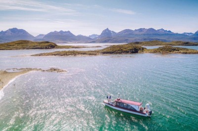
- 🚤 From Ushuaia (Argentina): International crossing by speedboat to Puerto Navarino, followed by a scenic drive along the Coastal Route to Puerto Williams.
Questions & Answers
What is the difficulty of the Dientes de Navarino Trek in 5 days?
It’s considered a medium-high difficulty trek due to the rugged terrain, extreme weather conditions, and the length of the circuit—about 25 miles (40 km), or 30 miles (48 km) if you include the full route to and from Puerto Williams.
How is the team that accompanies us during the Dientes de Navarino expedition?
The expedition is led by a guide specialized in the route and supported by a porter and a cook-porter. Together, they make up the logistics team that ensures your experience is safe, smooth, and enjoyable.
What is the maximum group size?
Groups are small and exclusive, limited to just 6–7 people, ensuring a personalized and safe trekking experience.
Where do you camp each night and are there campsites available?
There are no formal campsites along the circuit. Each night, we camp in previously scouted locations chosen by our team for their safety, flatness, and natural shelter—allowing you to fully immerse yourself in the wilderness of Navarino Island.
Do I have to carry a lot of water?
No, just bring a reusable water bottle. You’ll be able to refill it along the way directly from rivers and streams—the water is clean, cool, and drinkable😊.
What kind of food is offered during the trekking?
We offer hearty, energy-rich breakfasts and dinners to help you recharge. Lunches are lighter, designed to be quick and to keep your body warm. At the start of the trek, you'll also receive a personal pack of snacks and trail rations to manage throughout the route.
Can I participate if I have any dietary restrictions?
Yes, but it's very important to let us know in advance. After confirming your booking, you’ll receive a personal info form where you can list allergies, intolerances, or dietary preferences. Since logistics are complex in this remote area, early notice ensures we can meet your needs.
What type of clothing and equipment should I bring?
After confirming your reservation, we’ll send you a detailed packing list. In general, we recommend clothing suitable for cold and wet conditions—such as gloves, thermal base layers, and sturdy trekking boots.
Can I bring my own equipment?
Yes, you're welcome to bring your own equipment. However, it must be reviewed and approved during the pre-trek briefing to ensure it’s adequate for the terrain and weather conditions.
Will I have telephone or internet coverage during the trek?
There’s no cell coverage along the route. For your safety, our team carries a satellite device for emergency calls and messages. Before departure, we’ll confirm the emergency contact information of the person you list on your form.
Can my relatives follow my route in real time?
Yes! If you wish, we can send your designated contact a live satellite tracking link so they can follow your location during the expedition.
What happens if it rains or there is bad weather?
The expedition takes place in a region known for rapidly changing and often extreme weather conditions. Our team is trained and equipped to adapt to these situations and make safety-focused decisions in real time. That said, having the right gear and prior experience with multi-day tent trekking is essential for enjoying the route safely and comfortably.
5-Day Dientes de Navarino Circuit Hike tour reviews with Howlanders
Other tours that might interest you
- NOVEMBER-MARCH(2 reviews)Puerto Williams, Chile1 daySpanish and EnglishFree cancellation!
- NOVEMBER-MARCH(2 reviews)Puerto Williams, Chile1 daySpanish and EnglishFree cancellation!
- NOVEMBER-MARCH(1 reviews)Puerto Williams, Chile1 daySpanish and EnglishFree cancellation!
- OCTOBER-MARCH(7 reviews)Puerto Williams, Chile1 daySpanish and EnglishFree cancellation!
Other travelers also booked
- (3 reviews)Ushuaia, Argentina1 daySpanish and EnglishFree cancellation!
- (6 reviews)Ushuaia, Argentina1 daySpanish and EnglishFree cancellation!
- RECOMMENDED(118 reviews)El Calafate, Argentina1 dayEnglish and SpanishFree cancellation!
- TRAVELER´S CHOICE(126 reviews)Puerto Natales, Chile5 daysSelf-guidedFree cancellation!