


O Circuit Patagonia Trek
Hike the 8-day O trek in Torres del Paine and discover Patagonia at its wildest
🔥 Get the lowest price of the season by booking now! 🔥 Limited availability.
Briefing
The O Circuit Patagonia is the most extensive route available in Torres del Paine National Park. Get ready to walk a total of 78.9 mi (127 km) in an eight-day self-guided tour over well-maintained trails.
Our tour includes everything needed to enjoy this experience to the fullest: transfers from Puerto Natales, full-board accommodation inside the park, meals with complimentary drinks (breakfast, lunch, and dinner), an entrance ticket to the National Park, and even a welcome kit with a few essential supplies.
The southern part of the O Circuit follows the same trails as the W Circuit, so you won’t miss Torres del Paine’s most emblematic sites, such as the Torres Base Viewpoint, French Valley, or Grey Glacier. In addition, walk on the north side of the Paine Massif (Paine Mountain Range), which is a lesser-known and less-traveled section of Torres del Paine. Connect with nature, discover a new frontier, and wake up to the most stunning landscapes during this all-inclusive tour 🌲.
Ready to tour the Torres del Paine “Circuito Grande” and get lost in the wilderness of Chilean Patagonia? Pack your bags, and keep reading to see the full itinerary of your quest.
Learn about all the tours in Torres del Paine, both guided and self-guided and start your adventure today—explore now!
Tour details
Included
- Park access ticket
- Bus transfer from Puerto Natales to Torres del Paine (round trip).
- 1 night of lodging in Serón Sector
- 1 night of lodging in Dickson Sector
- 1 night of lodging in Perros Sector
- 1 night of lodging in Grey Sector
- 1 night of lodging in Paine Grande Sector
- 1 night of lodging in Francés or Cuernos Sector
- 1 night lodging in Central or Chileno Sector
- Full board (7 breakfasts, 8 lunches, 7 dinners)
- Welcome kit
- Welcome drinks
Not included
- Breakfast day 1
- Dinner day 8
- Beverages
- Guide (available as an extra)
- Luggage porter (available as an extra)
- Grey Glacier Activities (available as an extra)
Important information
O Circuit Patagonia Trek Lodging options:
- Lodge (refugio) + Camping: The lodges are shared dorm-style rooms with 4 or 6 beds and include sheets and blankets or sleeping bags, depending on the location. It's not possible to sleep in a lodges every night, as there are no lodges in the Perros and Serón sectors—only campsites. Therefore, the “Lodge (refugio) + Camping” option always includes 5 nights in lodges and 2 nights camping.
- Camping: Includes a pre-set tent, sleeping bag, and sleeping mat. In the Serón, Cuernos/Francés, and Central/Chileno sectors, tents are safari-style, while in Dickson, Perros, Grey, and Paine Grande sectors, they are traditional tents. All tents accommodate 2 people, and if you’re traveling solo, you’ll be assigned a tent just for you.
🥖🥑 This tour provides full board with meals at all accommodations (campsites and lodges), including Camping Los Perros (Los Perros Campsite).
✍🏻 The tour can be customized—just get in touch with us and let us know what you'd like to change.
⛈️ The difficulty and risk level of this route increase significantly in adverse weather conditions, especially during episodes of strong winds or when large amounts of snow accumulate in the higher sections of the trail. Be cautious, equip yourself properly, and follow the safety instructions provided during the briefing and at each accommodation.
Cancellation policy
Free cancellations!
- If you cancel at least 90 days prior to the start of the tour, you will receive a 100% refund of the amount paid.
- If you cancel between 89 and 70 days prior to the start of the tour, you will receive an 80% refund of the total cost.
- If you cancel between 69 and 65 days prior to the start of the tour, you will receive a 50% refund of the total cost.
After this time or in case of a no-show, no refund will be provided.
*The same policies apply to reservation modifications.
O Trek Itinerary
Welcome Kit - Puerto Natales
Welcome to the Torres del Paine O Circuit
We know that an 8 day hike needs good planning, that's why a short briefing is held in-person or online before the tour.
A few days before your arrival to Puerto Natales you’ll receive an email with instructions on how to pick up your welcome kit and resolve any questions or doubts you may have.
DAY 1 Puerto Natales - Torres del Paine - Camping Serón
Difficulty: Medium - low
Distance: 9 mi (14 km)
Total approximate time: 4-5 hours
Positive elevation gain: 951 ft (290 m)
Lodging: Camping Serón
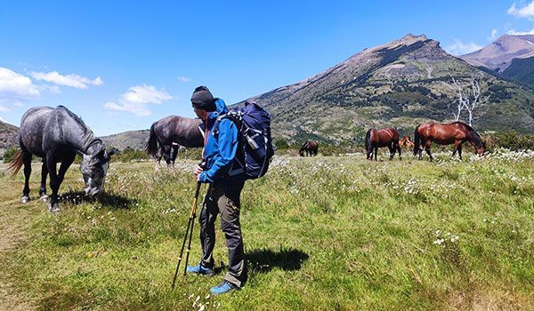
✨ Highlights: Meadows with horses along the Paine River
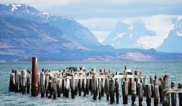
Puerto Natales - Bus Station
On the first day of the tour, you’ll go to Puerto Natales Bus Station and catch the bus going to Torres del Paine at 7:00 am. You’ll be taken to the Laguna Amarga gate, where you’ll first register as a visitor before entering the park.
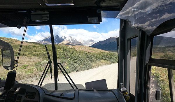
Welcome Center Torres del Paine
After checking in, take the shuttle bus and in just a few minutes arrive to the Welcome Center of the Cerro Paine Reserve. This is where your route begins! Be prepared to enjoy the spectacular views of Torres del Paine and the Almirante Nieto Massif from there.
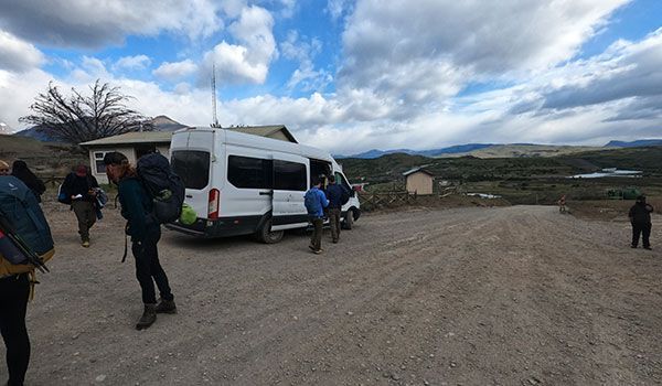
Beginning the O Circuit Patagonia
The route is nearly 9 mi (14 km) long and can be divided into three parts: the initial ascent of 820 ft (250 m) over nearly 4 mi (6 km). This section traverses the vast Lenga Forest, a woodland covered in lichens, a plant also known as "old man's beard". When you reach the peak you’ll have views of the valley and the Paine River.
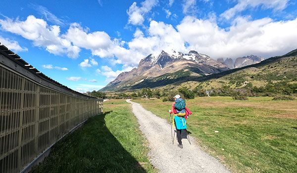
Continue the route downhill for about 2 mi (3 km) until reaching the flatland at the bottom of the valley. This meadow is home to daisies and a herd of wild horses.
Camping Serón
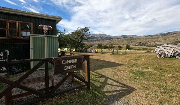
You should finally arrive at the Serón Sector after spending time in the meadow. In this sector the only available accommodations are the premium campsite tents. These tents are assembled before you arrive at the campsite and are fully equipped with the essentials for a good night’s sleep. The campsites have a shower and a communal dining room where meals (dinner and breakfast) are served. Don’t forget to stop at the bar and have a drink to celebrate your first day on the road!
DAY 2 Seron to Dickson trekking
Difficulty: Medium
Distance: 12 mi (18.7 km)
Approximate total time: 6-7 hours
Positive elevation gain: 1,181 ft (360 m)
Lodging: Dickson Sector: premium campsite or lodge
✨ Highlights: A beach overlooking the Dickson Glacier next to the lodge
Camping Serón - Paine Lake
Day 2 begins with breakfast at about 8:00 am in the dining room (exact times will be assigned at check-in). Don’t forget to pick up your lunch before leaving! You’ll be hungry at the midpoint of your route.
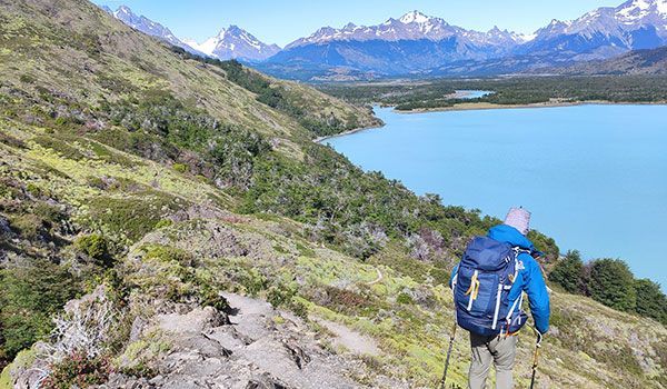
Today’s portion of the O circuit is divided into two sections. Beginning with a flat 2 mi (3 km) along the Paine River, then accompanied by a stretch of 2.5 mi (4 km) where you’ll climb and descend about 656 ft (200 m) the slopes of Mount Paine adjacent to Lake Paine. At the peak of your hike, you’ll have unspoiled views of Paine Massif and crystal-clear waters typical of glacial lakes.
Lake Paine - Dickson
The second portion of the route consists of flat spaces followed by a few hills. Shortly after descending from the slopes of Cerro Paine, you’ll find a CONAF (park ranger) post and a restroom, (take advantage of it because the WCs are few and far between).
Part two of the route passes close to the Paine River, which is usually a very hot and humid area. This is a good time to put on some insect repellent because it’s the place you’ll most likely encounter mosquitoes. Next, cross a stretch of walkways installed to prevent erosion of wetland areas. Finally, arrive at the Dickson Sector. This sector features a campsite, a lodge with a small dining room, cozy rooms, and very good showers.
💙 Howlanders Tip
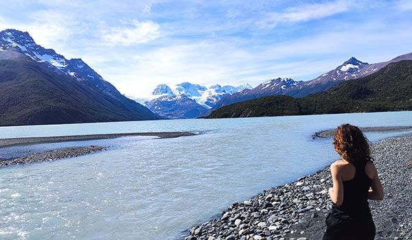
When you get to the Dickson Sector we recommend going to the beach that sits just a stone’s throw away. Catch your breath at the water’s edge of Lake Paine and take in the picturesque views of the glacier too. This is usually a very tranquil area, perfect for relaxing.
DAY 3 Trekking from Dickson to Los Perros
Difficulty: Medium-low
Distance: 8 mi (12.5 km)
Total approximate time: 4-5 hours
Positive elevation gain: 1,411 ft (430 m)
Lodging: Los Perros Sector: Campsite
✨ Highlights: Los Perros Glacier Overlook
Beginning of the Los Perros Trek
Scarf down breakfast, grab your lunch, and head out for another adventure in Torres del Paine. This is one of the calmest routes of the O circuit, with almost 8 mi (12.5 km) in length and no steep slopes. Little by little, climb to the Los Perros Campsite. After a small initial ascent, you’ll find yourself surrounded by the Lenga Forest (you’ll be crossing the forest for almost the entire route). If you like bird watching, this is the perfect day for you. While in the forest, keep your eyes peeled: the forest is so dense that not much sunlight makes it through to the forest floor, creating a cool and shady environment perfect for countless birds to thrive.
Take it easy and enjoy the tour. Some portions of the route approach the slopes next to the river and feature several viewpoints. This is where many hikers rest and take respite from the mosquitos.
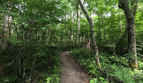
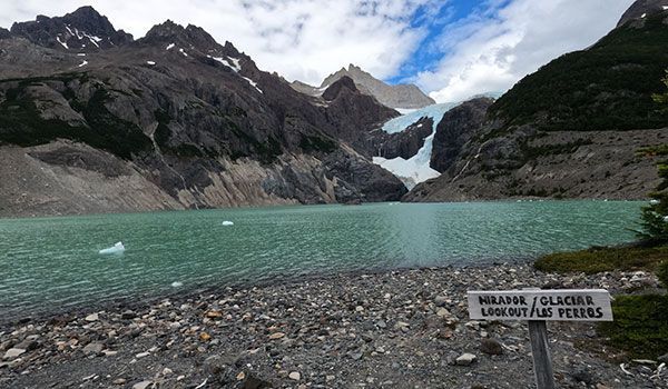
Los Perros Glacier
In the final section of the route, cross a few wooden bridges and climb 330 ft (100 m) up the moraine of the glacial lake until reaching the Los Perros Glacier.
This part of your tour is sure to be a standout. Why? Because, as you climb up the moraine, you won't have a good view of what's ahead of you until you reach the peak. Then, suddenly, you’re gazing at a breathtaking view: a crystal blue lake with a hanging glacier, a truly splendid moment!
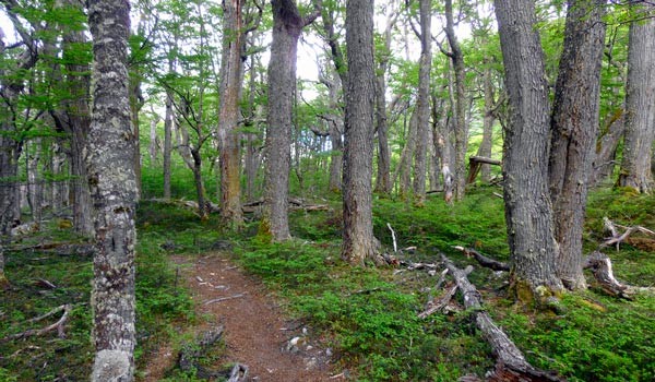
Lengas forest
In the forest, you’ll find an endemic bird species of the region, the Magellanic Woodpecker. Throughout the route, take care to spend some time enjoying one of the best locales for observation. The Magellanic Woodpecker can be found in a small clearing in the Lenga Forest, where you can see the glaciers in the surrounding area. You won't regret it!
Camping Los Perros
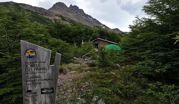
Almost there! Just a few more minutes of walking and you’re at the Los Perros Campsite. This campsite is located in an area that is very isolated and hard to access therefore, there is no lodge. The showers are cold, while the food is more rustic.
DAY 4 Los Perros - Grey Trekking
Difficulty: High
Distance: 11 mi (17.2 km)
Approximate total time: 9-10 hours
Positive elevation gain: 2,920 ft (890 m)
Lodging: Grey Sector: campsite or lodge
✨ Highlights: Views of Grey Glacier and its southern ice field
Southern Ice Field
We recommend starting the day early, this is vouched for by park employees who recommend leaving as early as 8:00 am. With such a long day ahead, it is important to accurately calculate your walking speed so as to arrive at the next campsite at a reasonable time. This is undoubtedly our favorite part but also the most challenging route of the O Torres del Paine Circuit, however, your hard work and dedication will be rewarded.
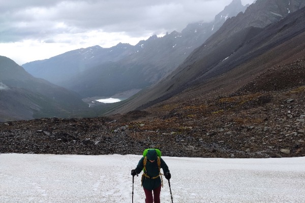
The route is divided into three sections. In the first stretch, you’ll leave the lenga forest where Los Perros is nestled and begin the ascent to the John Gardner Pass: 3.1 miles (5 km) with an elevation gain of 1,844 feet (562 meters). This is the most challenging part of the entire circuit, especially in adverse weather conditions, as large amounts of snow can accumulate and strong wind gusts are common. That’s why we recommend wearing gaiters and microspikes in these conditions. Check our "What to bring" section to make sure you’ve got the right gear.
John Gardner Pass
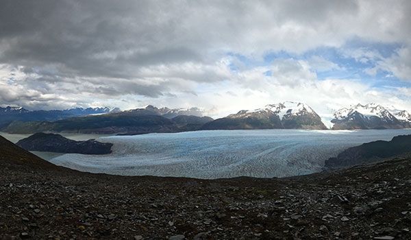
Step by step, climb to the top of John Gardner Pass. The peak of the pass delivers yet another stunning view: the O Circuit featuring the South Patagonian Ice Field, several glacier tongues, Grey Glacier, and hopefully a rainbow. We only have one word for you: enjoy!
Grey Glacier
Part 2: begins with the descent from Gardner Pass to the trail running close to the glacier. This section is particularly difficult because of both the slope and terrain: stone and aerial roots. The terrain may slow your progress but remember to watch your step! (aerial roots are above ground roots from trees that are easy to trip over)
This stage ends with your arrival at a CONAF camp known as "El Paso" where many travelers take the opportunity to eat a lunch box.

Grey Sector
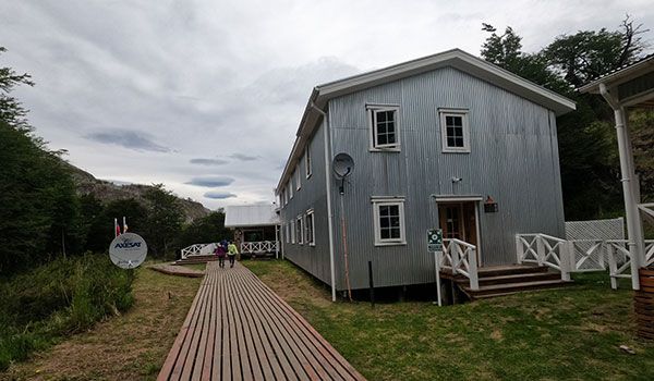
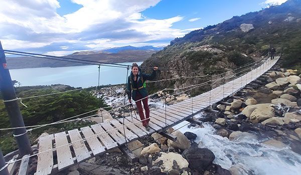
With its reliably spectacular views, Grey Glacier remains on your right as you make your way through Part 3 of this stage of the trek. There's nothing like a leisurely nature stroll, with no slope, good views, and teeming wildlife about. Another great perk of this part of the trek are the three suspension bridges used to cross the Grey Sector. At the refugio, enjoy a drink at the bar or relax on the terrace.
DAY 5 Trekking to the Paine Grande Sector
Difficulty: medium-low
Distance: 7 mi (11 km)
Approximate total time: 3-4 hours
Positive elevation gain: 1,083 ft (330 m)
Lodging: Paine Grande Sector: campsite or lodge
✨ Highlights: Grey Activities (extra) and Grey Lookout
Activities on Grey Glacier
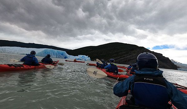
As is often the case on the full Torres del Paine circuit, after a tough stage comes an easier one. The route between the Grey and Paine Grande sectors is particularly gentle, giving you plenty of time to enjoy an activity on Grey Glacier. For many travelers, walking with crampons on the glacier ice or kayaking among icebergs is one of the top experiences in Torres del Paine. Plus, booking through the links below is more affordable than adding it as an extra when reserving your tour 😉:
These activities take place in the morning, as the hike for that day only takes 3 to 4 hours (1.9 to 2.5 miles), so you’ll have time for everything.
👉 It’s not possible to do both activities on the same day due to time constraints.
Trekking in the Paine Grande Sector
The route will be short at only 6.83 mi (11 km). Beginning with a flat stretch, it gradually climbs to about 656 ft (200 m) of elevation. Soon, the forest will open up to you, and you’ll begin descending into the Paine Grande Sector.
The visual treat of Paine de Grande is the gift that keeps giving: throughout the day, you'll have incredible views on either side of your trek. On your right, is Lake Grey, accompanied by the diminishing glacier sitting behind it. To your left sits the Paine Massif with the Cerro Paine Grande, peaking at an altitude of over 9,185 ft (2800 m).
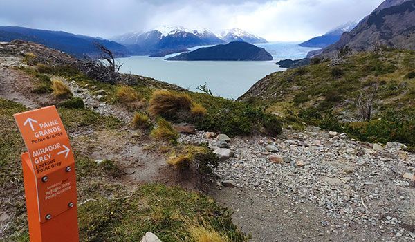
Lake Pehoé - Paine Grande Sector
In the last stretch, the trail diverges from Grey Lake and heads downhill towards the Paine Grande Sector. This sector is one of the largest in the park and is located in front of Pehoé Lake. The large, well-equipped refugio features a lively bar.
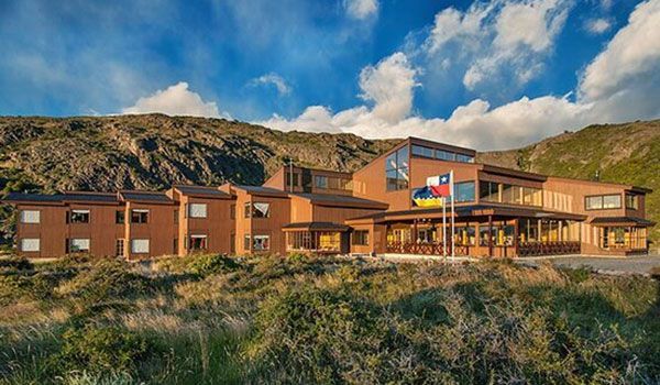
DAY 6 Trekking French Sector - Cuernos
Difficulty: medium-high
Distance: 14 mi (23 km) to Francés Sector / 17 mi (27 km) to Cuernos Sector
Approximate total time: 8 hours to Francés Sector / 10 hours to Cuernos Sector
Positive vertical drop: 2,625 ft (800 m) to the Francés Sector / 3,215 ft (980 m) to the Cuernos Sector
Lodging: Francés Sector or Cuernos Sector: premium campsite or lodge
✨ Highlights: French Viewpoint + British Viewpoint
To be taken into account
To clarify: there is an optional segment of this route. The portion that ascends to the French or British Viewpoints are optional. You'll have the choice of accessing the viewpoints or going straight to your accommodations, reducing your trek by 8 mi (13 km) from the O Circuit route and avoiding almost all the slope.
However, your assigned accommodations may be in the Francés Sector in Cuernos, which is 2.5 mi (4 km) away from each other. So, let's get started!
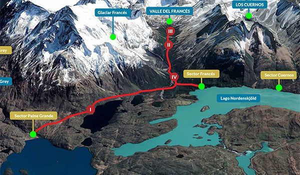
Route to Campamento Italiano
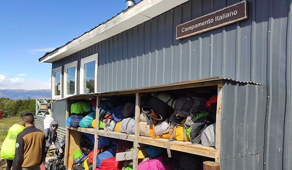
This route is divided into three parts. The first part is a 5.6 mi (9 km) segment with almost no slope until reaching a CONAF camp (park rangers) known as the Italian Camp. Before arriving, you’ll reach the intersection leading directly to Francés or Cuernos. At Howlanders, we believe it’s worth the effort to at least climb to the French Viewpoint. If you continue down the trail leading to the viewpoints you’ll arrive at the Italian Camp (Campamento Italiano), where we recommend taking advantage of the nursery and leaving your heavy luggage. Travel light by taking a small pack to carry water, snacks, and something warm.
💬 “Guarderia” The nurseries or guarderias in Torres del Paine are at strategic points along the route and where you can leave your backpack, eliminating the need to carry heavy luggage. Pick up your luggage upon returning from the viewpoints and continue down the same road to continue your day’s trek.
Francés and Britanico lookouts
Part two begins by crossing the French Valley to reach its viewpoint overlooking Mount Paine Grande and its hanging glaciers. Trekkers can expect to walk 1.5 mi (2.5 km) and climb about 984 ft (300 m) of elevation gain in this portion.. If you’re lucky, you might even hear some ice cracking as it breaks off.
This second stage continues with the ascent to the British viewpoint: 2.5 mi (4 km) with a climb of 918 ft (280 m) in elevation gain. At the viewpoint, large boulders crowd together to serve as a lookout to create a 360-degree panoramic view. Take a look at our trek photos, they speak for themselves…
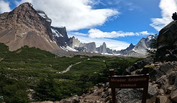
Return to Francés Sector - Cuernos
You’ll start your descent along the same path. When arriving at the Italian Camp, don’t forget to pick up your backpack, and if you haven’t already, stop and have lunch (fellow trekkers will most likely be eating here as well). From the Italian Camp to the Frances Sector expect to continue walking for about 1.55 mi (2.5 km). However, if you’re assigned to the Cuernos Sector, that walk will be 2.5 (4 km) more. Fortunately, this gives you the opportunity to walk along the Lake Nordenskjöld and stroll its beaches.
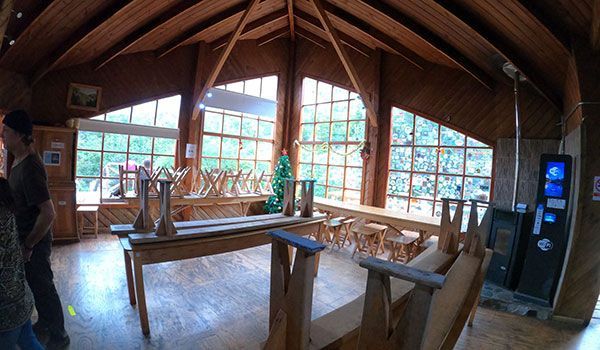
☝ Accommodations Francés Sector - Cuernos Sector
Francés and Cuernos sectors have the smallest yet coziest accommodations in the park. This is because they are not easily accessible sites. The Chileno Sector is assigned when the Francés Sector is full, especially if traveling in high season. The Chileno Sector also only features a campsite at an additional cost.
DAY 7 Central Sector Trekking
Difficulty: medium-low
Distance: 11 mi (17 km) from the Francés Sector / 8 mi (13 km) from the Cuernos Sector
Total approximate time: 6 hours from Francés Sector / 4.5 hours to Cuernos Sector
Positive elevation gain: 1,706 ft (520 m) from Francés Sector / 1,115 ft (340 m) from Cuernos Sector
Lodging: Central Sector: premium campsite or lodge
✨ Highlights: Route along Lake Nordenskjöld
Francés Sector - Cuernos
As previously mentioned, a hard day of trekking is usually followed by a calm day. So, take it easy on day seven. Today’s route is not too challenging, with a small initial slope of 655 ft (200 m) when leaving the Cuernos Sector.
The remainder of the day is very flat until reaching the small descent leading to the Central Sector. Enjoy the day and the views of the Cuernos del Paine on one side and Lake Nordenskjöld on the other.
Central Sector
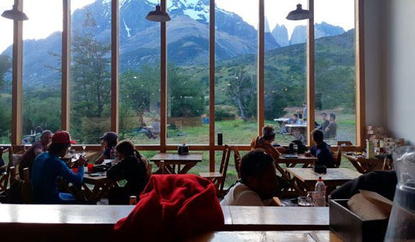
When reaching the Central Sector, you’ll notice that both the campsite and refugio are large, similar to the Paine Grande Sector; both sectors serve as entrances to the national park. As a consequence of its centrality, you’ll have the chance to meet many travelers, relax in the large common areas, and of course enjoy one of the liveliest bars on the route.
DAY 8 Base Torres Trekking
Difficulty: medium-high
Distance: 14 mi (22 km)
Approximate total time: 9-10 hours
Positive elevation gain: 3,517 ft (1,072 m)
Lodging: not included (return to Puerto Natales)
✨ Highlights: Torres Base Viewpoint
Ascencio River Valley - Windy Pass
We’ve saved the best for last! Undoubtedly the most popular route in Torres del Paine, this is the route you’ll be trekking on your final day. We’ve divided it into three sections: part one is a 1.25 mi (2 km) walk with a little elevation gain that also crosses the river valley, part two continues for 1.86 mi (3 km) and ascends along a path without the lodge of trees to the Paso de los Vientos and its panoramic views, and part three begins in the Moraine and ends with your return to Puerto Natales.
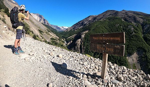
Lenga Forest - La Morrena
The next 2.48 mi (4 km) will be a segment with very little slope that passes by the Chileno Sector. Little by little you’ll enter the Lenga Forest until reaching the Moraine, an area with large boulders that we would consider the beginning of the third section and the most difficult segment of the day’s hike.
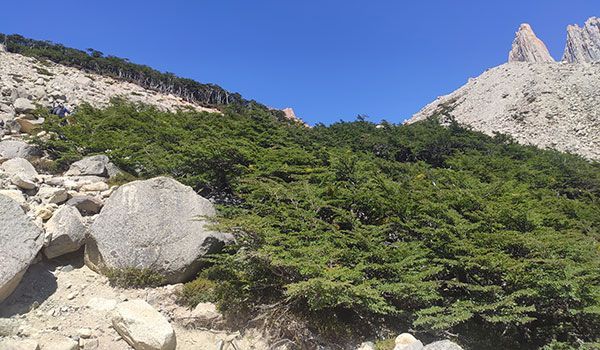
Base Torres Viewpoint
For almost 1.24 mi (2 km) you’ll have to hike uphill around large blocks of rock, a somewhat challenging segment leading to a well-deserved reward: The Base Torres Viewpoint. The viewpoint offers stunning vistas of the glacier lake crowned by the three granite towers that lend the park its name. Relax, take a few pictures, eat lunch with the phenomenal landscape, and of course, enjoy!
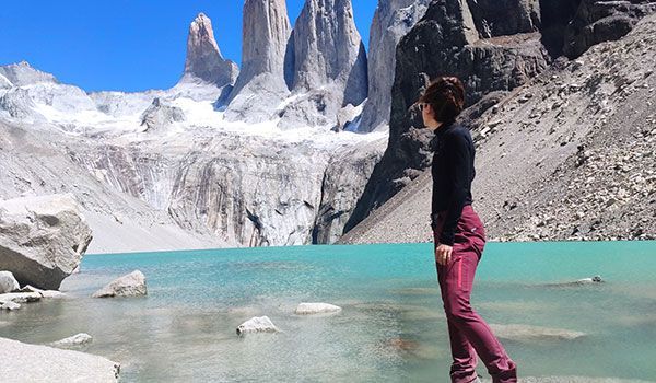
Return to Central Sector - Puerto Natales
Start your journey back by walking along the same trail that has led you to the most iconic views of the park. When you arrive at your lodging in Sector Central or Chileno, you’ll collect your backpack and take it to the Welcome Center. Here, board the shuttle bus that will take you back to the park entrance, Portería Laguna Amarga. From there, catch the bus to Puerto Natales around 9:30 pm, thus ending your incredible adventure in the O Circuit Patagonia.
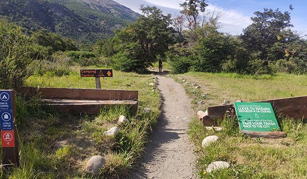
What to bring to O Circuit Patagonia Trek tour
The weather in Patagonia changes considerably throughout the day, with travelers sometimes experiencing all four seasons in a single day. The summers commonly (when the tour takes place), have strong winds. Therefore, we advise bringing clothing for different climates and wearing a 3-layered system. We also recommend keeping the weight of your backpack under 10% of your body weight. Below is a guideline of recommended essentials:
- Passport
- PDI: Migratory Card (for foreign travelers not residing in Chile)
- Lodging reservation ticket
- Thin hiking pants or shorts.
- Warm/waterproof hiking pants.
- Long/short sleeve T-shirts
- Sport or trekking socks
- First layer: thermal T-shirt
- Middle layer: fleece lining or similar
- Outer layer: waterproof jacket
- Hat
- Hiking boots
- Resting shoes
- Sandals (for showers)
- Personal hygiene products
- Flashlight and battery (especially useful in campgrounds)
- Sunscreen
- Sunglasses
- Walking sticks
- Cash (USD or CLP)
- Medium trekking backpack (45 lbs/ 40 liters approx.)
- Small trekking backpack (33 lbs/ 15 liters)
- Long/short sleeve T-shirts
- Padlock for lockers
- Towel
- Gloves
- Gaiters for the John Gardner pass
- Water bottle
- Pillow (only necessary in some campsites)
Where does the tour O Circuit Patagonia Trek start
The tour begins and ends at the Puerto Natales Bus Terminal. On the first day, you’ll take the bus that departs at 7:00 AM, so we recommend arriving at least 15 minutes early. On the last day of the tour, you’ll return to the same station at 9:30 PM.
The transfer between Puerto Natales and Torres del Paine National Park is made by regular bus (ticket included in the tour) both on the outbound and return trips, and it is not possible to change the arrival time in Puerto Natales.
👉 Find out how to get to Puerto Natales and check all available transport options.
Questions & Answers
My preferred dates are not available, is there an alternative?
Yes, Howlanders will do everything possible to help you book this trek by providing alternative dates, itinerary modifications, etc... please don't hesitate to contact us.
What are the Refugios in Torres del Paine National Park like?
The refugios (mountain lodges) have large common areas, bars, and dining rooms available to travelers staying at the campsite. The rooms are shared with approximately 6 people, and have good beds, a reading light, and a plug next to the bed. We have created a post for you to get to know the different lodges in the park: Torres del Paine accommodations.
How are the campsites in Torres del Paine National Park?
There are two types of campsites depending on the sector. In some sectors, campsites feature tents mounted on wooden structures, while others are closer to "glamping", accompanied by a large tent raised off the ground (similar to safari-style tents installed atop land cruisers). All campsites have toilets and showers (with limited hours) and a common kitchen (which you won’t have to use because the tour includes all meals served in the dining room of the lodge). You can see the different types of campsites in the tour album.
Is lunch included and where do I eat at lunchtime?
Yes, the tour includes breakfast, lunch, and dinner. For this tour, breakfast and dinner are served at the lodge dining room, and are available to all trekkers staying at the campsite. For lunch, a "lunchbox" is provided, which you can pick up at breakfast time and enjoy while on the day's trek. The lunchbox is packed with optimal foods for physical activity: nuts, cereal bars, fruit, a sandwich, and some sweets.
What documentation do I need to bring to enter the Torres del Paine National Park?
To enter Torres del Paine National Park, you must provide your: passport, park entrance ticket, accommodation reservation document, and immigration card (issued during passport stamping).
Do I have to carry my backpack throughout the entire O trek?
The O Trek is a circular route that requires trekkers to carry their packs for most of the route except in two sections: The French Valley and Central Sector. The French Valley Trek will have a "guarderia" (a locker next to the park rangers station) to leave your backpack and pick it up on the way back and on the Base Torres Trek, hikers can leave their packs in the Central Sector.
Do I have to take all my luggage to Torres del Paine?
No, at Howlanders, we recommend carrying only the necessary items for the eight-day trek. The most convenient option is to leave your remaining luggage at your accommodations in Puerto Natales. Remember, we don’t advise carrying a pack of more than 10% of your weight; typically about 18 pounds (8 kg).
Should I carry a lot of water?
No, that won’t be necessary, just be sure to bring a refillable bottle (you’ll be given one in the welcome kit). Drinking water is available at the refuges and campsites. Throughout the tour, you’ll have the chance to refill your bottle directly from the rivers; they’re drinkable and cool 😊.
Where does the bus to Torres del Paine National Park leave from?
The bus leaves Puerto Natales Station, also known as "Terminal Rodoviario." Puerto Natales is a small town and the walk to the station is usually less than a 20-minutes. Taxis are also available.
Can I complete the O Circuit with a guide or porter?
Yes, if you’d like a private professional mountain guide (exclusively for your group) to walk the O Circuit Trails with, or a porter to help carry your packs, just contact us.
To book as a Chilean or foreigner residing in Chile, what documentation is needed?
After the reservation is processed, you will be asked to present a valid passport or identity document proving your nationality or country of residence. If this documentation is not presented, you’ll be required to pay the difference in price of the non-resident foreign traveler rate in Chile.
How difficult is the Patagonia O Trek? Is the Circuit hard?
The O trek is not particularly challenging, however, we consider it a medium-high difficulty trail. The portion of the trail linking Los Perros Sector and Grey Sector is considered the most difficult stage due to its length and unevenness. The John Gardener Pass is another tricky segment of the trail due to snowfall. On the other hand, the O Circuit is an eight-day adventure, and fatigue over that period also contributes to the hike’s difficulty. Luckily, the itinerary has been created to pair longer and more difficult stages with shorter and easier ones, allowing hikers time to recover.
How long does it take to complete the O Circuit?
The O Circuit is a route that lasts eight days. It is completed in a counter-clockwise direction, starting and ending in the Central Sector.
How much does it cost to hike the O circuit?
The O Circuit costs about $2,000. Depending on the types of accommodations booked, the price may vary. This price includes all the necessary services such as transportation, accommodations, and full board.
Is a guide needed for the Patagonia O Trek?
During the winter season (October to March), hiring a guide to complete the O Circuit in Torres del Paine is unnecessary, in fact very few travelers do. Guides have their benefits: they’ll provide information about the park and help you understand what your eyes see. A porter service is also offered for travelers who do not wish to carry their luggage.
How many miles is the O Circuit?
The complete O Circuit in Torres del Paine covers 79 mi (127 km) over eight stages. There are short stages, as little as 7 mi (11 km), while others are much longer, over 13 mi (22 km).
What kind of accommodations are available in the O Circuit?
Travelers can book accommodations in the camps only, or by combining camps with lodges (aka refugios). Some sectors are limited to only a campsite, therefore it won’t be possible to spend every night in a lodge.
What is a self-guided tour?
A self-guided tour is a route that does not require a guide and provides travelers the freedom to walk at their own pace. This self-guided tour is very easy to follow because the paths are very well-maintained and marked. A map is also provided, containing information on both the route and the surrounding areas.
Do I have to carry my camping equipment during the tour?
No, all tents are assembled at the campsites, and upon arrival, each traveler will be assigned a tent. Each tent is equipped with a mat and sleeping bag.
Can I request a special diet?
Yes. When booking, please tell us which option you want from the available choices:
• Standard (no restrictions)
• Vegetarian
• Vegan
Gluten-free menu: we can adapt it, but we cannot guarantee the absence of cross-contamination due to shared kitchens.
Recommendation: if you have celiac disease or a severe gluten intolerance, contact us and we will help arrange your booking.
O Circuit Patagonia Trek tour reviews with Howlanders
Other tours that might interest you
- W TREK & GREY(39 reviews)Puerto Natales, Chile6 daysSelf-guidedFree cancellation!
- TRAVELER´S CHOICE(122 reviews)Puerto Natales, Chile5 daysSelf-guidedFree cancellation!
- (2 reviews)Puerto Natales, Chile5 daysSelf-guidedFree cancellation!
- (18 reviews)Puerto Natales, Chile5 daysSelf-guidedFree cancellation!
Other travelers also booked
- (7 reviews)Puerto Natales, Chile1 daySpanish and EnglishFree cancellation!
- (12 reviews)Puerto Natales, Chile1 daySpanish and EnglishFree cancellation!
- RECOMMENDED(110 reviews)El Calafate, Argentina1 dayEnglish and SpanishFree cancellation!
- NOVEMBER-MARCH(3 reviews)Puerto Williams, Chile5 daysSpanish and English


